
I discovered Google Earth when my earstwhile boss saw me bored one Saturday afternoon in the office. I was so amazed with the software. You can easily download it anyway for free. Just by clicking and rolling your mouse, you can go to places and see them as if you are riding on an airplane. The pictures are taken from a powerful cameras on satellites roaming the earth atmosphere. You can view different cities and see how they were planned. No doubt Goggle Earth is an effective tool on doing research on urban planning and architecture of modern cities of the world.
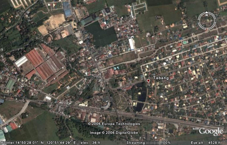
 To my surprise Tabang, my hometown, is very detailed-ly done in Goggle Earth. The rusty corrugated roof of our house in Maligaya Subdivision is very visible and upon seeing this makes me happy and proud that our little abode exists in this vast earth landscape! And like in an airplane indicators, GE can even indicated bearing and can measure distance both lenght and altitude. Saying this, may I say that our our house is precisely located at Latitude 14°50'38.23"N and Longitude 120°51'50.11"E. Scientific huh?!
 I am still navigating the world and GE is continually updating. Im traveling the world from the comfort of an internet cafe and with my passport unvisaed!
Kudos to Goggle Earth!!!
1 comment:
Galing ng google earth, no?
I was thinking, if only we can have a VR (virtual reality) version of this, i bet it would be fun. Something like the Rialto in Enchanted Kingdom. I'm sure, patok yon.
Post a Comment